


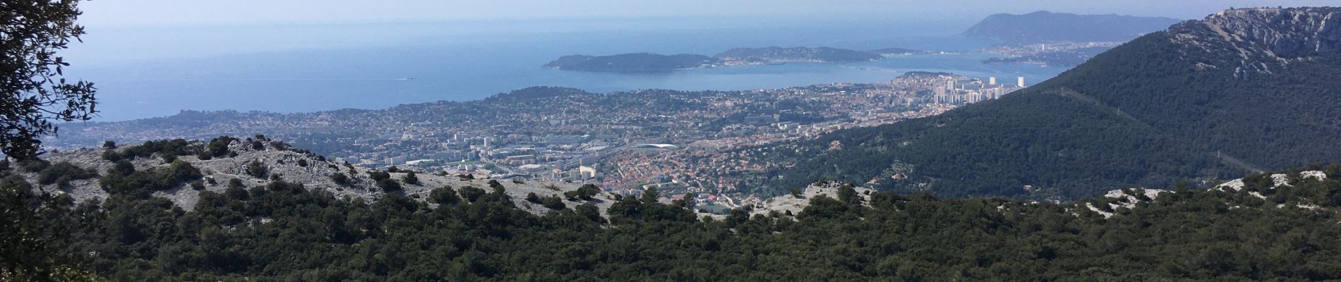
Le Coudon depuis la Farlède (Variante)

BerFran
User
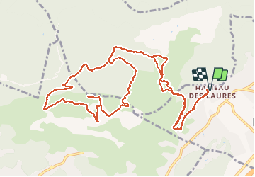

Length
16.6 km

Max alt
652 m

Uphill gradient
601 m
Km-Effort
25 km

Min alt
127 m

Downhill gradient
601 m
Boucle
Yes
Creation date :
2021-04-19 06:53:52.0
Updated on :
2021-04-22 09:19:40.464
4h56
Difficulty : Medium

FREE GPS app for hiking
 SityTrail
IGN / Geographical institutes
SityTrail Plus
The world is yours!
About
Trail Walking of 16.6 km to be discovered at Provence-Alpes-Côte d'Azur, Var, La Farlède. This trail is proposed by BerFran.
Photos
 - Photo 1")
Positioning
Country:
France
Region :
Provence-Alpes-Côte d'Azur
Department/Province :
Var
Municipality :
La Farlède
Location:
Unknown
Start:(Dec)
Start:(UTM)
258306 ; 4783475 (32T) N.
Comments